Oceangoing Cargo Ships Safety & Operational Matters
Home || Tanker Safety || Container Ship Handling || Commercial Management || EMS ||

Procedure for passage planning on ECDIS - a brief guide to navigators at sea

ECDIS, which is now a mandatory shipborne navigational equipment for voyage planning and execution, can operate a variety of charts. The official charts are known as Electronic Navigational Charts (ENC) and Admiralty Raster Chart Service (ARCS). The charts are made and distributed by the hydrographic offices through a distribution network, and the vessel has to subscribe to a service provider.

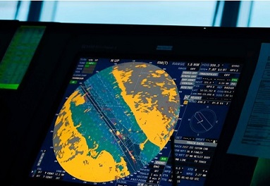
ECDIS uses digital charts (vectorized and raster charts) for navigational duties usually carried out with paper charts. The equipment must be type-approved and uses up-to-date official charts. As long as the area covered by vector charts (ENC) is small, the ECDIS should be able to cover both vector and raster (RNC) charts. When operating in raster mode, an ECDIS must be used together with an appropriate folio of up-to-date paper charts.


containerships operational matters
Oil Tanker Safety Guide
For voyage planning, using an ECDIS is the same as with paper-based navigation. However, making a passage plan utilizing the full aspect of a type-specific ECDIS need some careful consideration. Summarized below some key points:
  1. The second Officer creates the draft plan
  2. ECDIS in operation
    ECDIS in operation

  3. Master studies entire route suggests improvements and eventually approves the final plan
  4. All deck officers require a briefing on the plan.

Appraisal :The first step is to broadly consider the routing and consider factors affecting the voyage:
Planning : When planning a route on ECDIS, always consider ENC display settings and, as with paper, use the best scale (1:1). Take time to check and scan routes. It is advisable first to conduct automatic route checking, adjusting the route each time to correct the alerts generated. One should then manually scroll along the entire route to visually check for any hazards.

IT TAKES TIME TO CHECK A ROUTE PROPERLY!

Remember potential limitations of route planning and checking on small scale ENCs.

Execution: The principles of good seamanship and maintaining a proper lookout apply when navigating electronically. Plan to use all available sources of information. Safety settings should be adjusted throughout the voyage to reflect the demands of the situation. For example, when coastal navigating, vectors, cross-track corridors (XTC) and guard zones should all be reduced.

Settings such as safety contours and safety depths should be set higher for ocean passages, to provide early warning of landfall, hazards or the possibility of increased traffic.

passage monitoring
passage monitoring

Monitoring :Do not rely solely on automatic alarms. A prudent navigator should always seek to prove the ECDIS wrong, rather than assuming it is correct. Use tools such as radar overlay (RIO) to assist with monitoring. An accurate RIO provides a "million point fix" and allows excellent real-time monitoring, but do not rely solely upon it. Normal radar limitations still apply.

Do not rely solely on GNSS input, such as GPS. Cross-check frequently with other systems such as LORAN-C and manual means, such as visual/radar fixing. Ensure that appropriate display settings are applied for Coastal/Ocean and Day/Night navigation. Use profiles if the functionality exists.

Perils of Over reliance

Over-reliance on a single means of navigation has always been wrong – this remains true with electronic systems, including ECDIS. What are some of the perils of relying solely on ECDIS? Some issues to consider:
  1. Screen fixation - tendency to become absorbed in an electronic display rather than looking out of the window.
  2. Failure to cross check – tendency to assume that the displayed position is correct without verifying position integrity by some other means.
Alarm management and appropriate use of tools are critical- e.g., failure to adjust settings appropriate to the situation that may be resulting in too much or too little information.

Specifically, over reliance can be contributed by the following:
  1. Chart survey data: date, type and its reliability
  2. Cartography- origin, compilation and update history of chart. Check reliability.
  3. Selection of chart data, data type, ENC limitations and scale selection. How to optimise ?
  4. Route planning - vessel data and corridor widths
Additional perils of over reliance:
  1. Measurement settings (distance/speed/depth)
  2. Chart symbol selections – simplified/traditional
  3. Correct viewing scale – clutter/SCAMIN?
  4. Orientation of display
  5. Number of depth shades
  6. Select/de-select shallow water pattern
Dependency on Traditional Navigation Techniques include following:
Integration of Traditional Navigation Techniques

These techniques remain valid and ECDIS provides a means to integrate them. It's worth considering:
  1. cross checking/variety of means
  2. integrating ECDIS use into navigation function
  3. looking out of window
  4. making sense of presentation
  5. maintain situational awareness at all times


Main features of shipborne ECDIS

North up/heads capability of ECDIS: In the normal north up mode, the ship moves across the static chart until it approaches the edge of the screen when a new section of the chart is automatically displayed. In heads up, the vessel remains in the center of the display while the chart moves underneath. The vessel always appears up on display with the image automatically rotated to the correct orientation, thereby matching the scene outside the window.

Radar overlay – A navigation system which superimposes live radar video output over ECDIS. It provides a scan-converted output for display, automatically scaled to suit the displayed chart. The transparency can be adjusted so that the chart can be seen through the radar image. The overlay and its controls conform to the ECDIS standard for combining radar with ECDIS chart display.

Electronic navigational chart (ENC), also vectorised chart – Vector charts made up of layers which can be displayed selectively. Each point on the chart is digitally mapped, allowing information to be used in a more particular way, such as clicking on a feature to display its information. Vector charts have the advantage of being "interactive." For instance, the operator can pre-set the vessel draught and a ½ mile exclusion zone. At any time when the vessel is within ½ mile of an area of shallow water, an alarm activates. Chart data can be shared with other equipment such as ARPA and radar. There are various chart formats. Hydrographic offices are responsible for the production and accuracy of the ENC material.


Related Information

ECDIS warning procedure
Although many vessels have fitted Electronic Chart Display and Information Systems (ECDIS) on a voluntary basis, its use will significantly increase once passenger vessels, tankers and dry cargo ships begin to comply with mandatory SOLAS requirements for ECDIS.

ECDIS alarm parameters
Safety Contour: Is to be set to the maximum dynamic draft, plus 10% of static draft. Note that ECDIS will select the next deepest contour contained as an object within ENC....

ECDIS warning procedure
Although many vessels have fitted Electronic Chart Display and Information Systems (ECDIS) on a voluntary basis, its use will significantly increase once passenger vessels, tankers and dry cargo ships begin to comply with mandatory SOLAS requirements for ECDIS.

Admiralty Chart correction procedure
There are currently two methods of carrying out electronic chart corrections, either via Weekly Updates, CD or downloaded weekly from a recognized electronic chart supplier's data. The preferred method will be decided by the Management Office depending on the communications equipment onboard the vessel, but in the majority of cases the lack of internet access will determine the update CD as the best option....

Requirement of ECDIS training and implementation guideline
To ensure compliance with the ECDIS requirement, to ensure that the transition is smooth, equipment installed and Master and Bridge watch keepers are all provided generic and ship-specific ECDIS equipment training before the implementation dates of various type vessel: .....

What are the safe navigational procedure for the officer of the watch? ....
The officer of the watch (OOW) shall comply with masters standing orders (including any supplementary instructions) to carry out the navigational watch. He must always bear in mind that he is the Master's representative and has primary responsibility at all times for the safe navigation of the ship and for fully complying with the latest COLREGS .....

Guidance on ECDIS- data presentation and performance check standards
Type approval is the certification process that ECDIS equipment must undergo before it can be considered as complying with the IMO Performance Standards for ECDIS. The process is conducted by type approval organizations and marine Classification Societies. ...


Other info pages !

Ships Charterparties Related terms & guideline
Stevedores injury How to prevent injury onboard
Environmental issues How to prevent marine pollution
Cargo & Ballast Handling Safety Guideline
Reefer cargo handling Troubleshoot and countermeasures
DG cargo handling Procedures & Guidelines
Safety in engine room Standard procedures
Questions from user and feedback Read our knowledgebase
Home page


ShipsBusiness.com is merely an informational site about various aspects of ships operation,maintenance procedure, prevention of pollution and many safety guideline. The procedures explained here are only indicative, not exhaustive in nature and one must always be guided by practices of good seamanship.

User feedback is important to update our database. For any comment or suggestions please Contact us
Site Use and Privacy - Read our privacy policy and site use information.
//Home //Terms and conditions of use

Copyright © 2015 www.shipsbusiness.com All rights reserved.